Today was another awesome day on the River to River Trail across southern Illinois. I packed up my car and left War Bluff Wildlife Sanctuary and drove to the Gum Springs trailhead, where I finished the previous day. Ruby was playing with my friend's dog all morning and seemed good as new so I decided to bring her along. As for myself, I was sore as I was the other mornings, but this was the first day I felt really tired. I noticed that I little irritation I felt on my right big toe had caused a little hot spot and needed to be dealt with. I learned the hard way many years ago that one needs to take care of his feet. One minor nuisance times 10,000 steps can turn into a big issue farther on down the trail. I taped it up with a bandaid and it felt fine all day.
 |
| At the Gum Springs trailhead |
I really wanted to see the Bleeding Buffalo pictograph along Cedar Creek, but the trail went in the other direction. I had a tight schedule to keep so I decided to come back another day and proceeded south across the bridge and headed right (west) into the woods. By the way, a pictograph is a prehistoric art that is drawn onto rock, whereas a petroglyph is carved into rock. Both exist in southern Illinois.
 |
| Ruby dog |
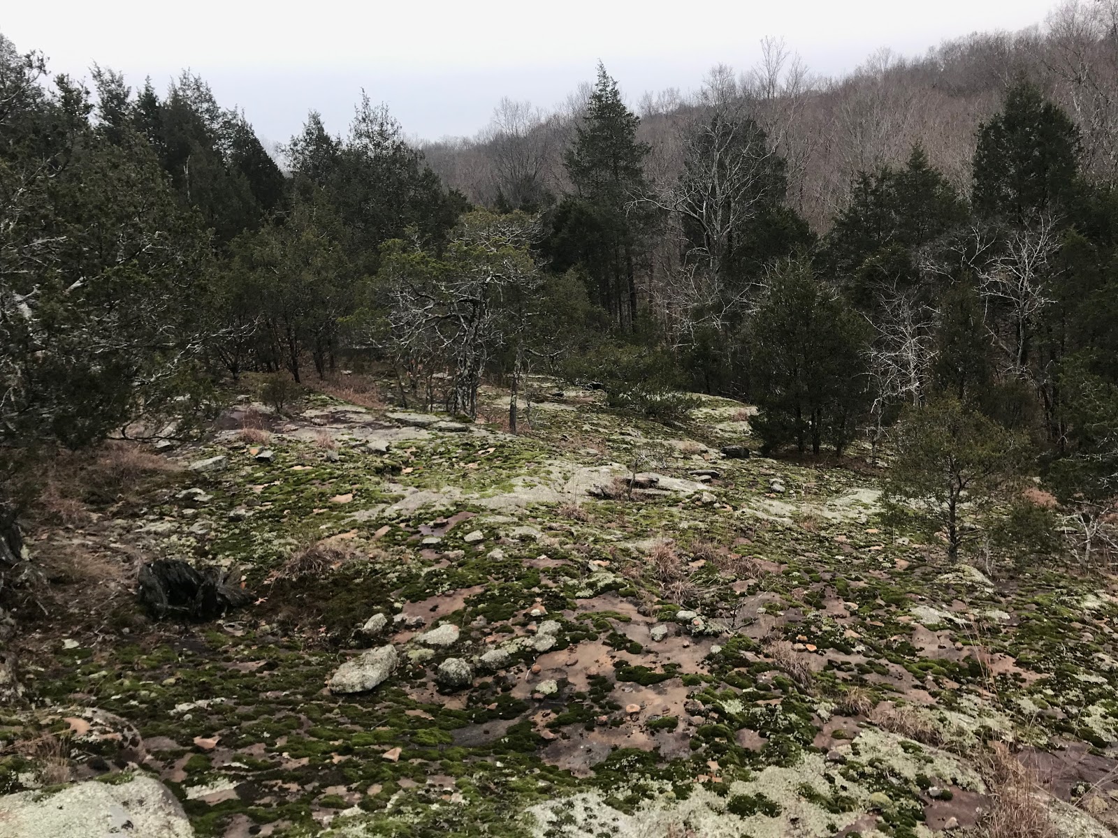
This is a spot where I think it would be better to follow the creek to the north and west instead, not only to see Buffalo Rock, but also because the official route goes up a hill through unexciting woods just to descend back into the valley once one gets to the top. But as I've said in earlier blog posts, I wanted to stick as close to the official route as possible (although at certain points I felt I had to deviate from the trail as I will mention later).
 |
| Feeder drainage into Cedar Creek |
After the unnecessary hill climb, the trail descended and followed along Cedar Creek, which was awesome. I can't believed I haven't previously explored this area. The creek was calm, but not too dry, which made the water clear and blue. A lot of creeks in southern Illinois are ephemeral so they only follow after rainfall, but due to conversion of the land to pavement and farmland when it rains the water is very brown. The water drains quickly so when it doesn't rain for awhile the creeks don't flow and water is only found in pockets along the rocky flowages. I happened to hit the trail at just the right time when the water was flowing, but it hadn't rained for many days so it was clear and blue like I mentioned above.
 |
| Blue water along Cedar Creek |
I needed to make progress, but I made sure to rest often, if only for a short time, and there was plenty to look at. People might think that there is little to see as far as plant life in December, but as I have mentioned in previous blog posts, many can still be easily identified, whether brown or green, woody plant or herbaceous plant. As I walked into the valley, I kept my eye for for plants I had not previously seen along the trail. After crossing a creek by a campsite, I traversed along the south facing slope on the south side of the creek and enjoyed the views.
 |
| Trail through the woods |
There are so many things that make hiking in the winter awesome, especially in southern Illinois. The climate is generally mild so when it does get cold, generally it doesn't last for long. Some people tell me they only hike in the wintertime, in fact, I heard of a former plant biology professor at Southern Illinois University that only did field research in the winter. He studied woody plants mostly and they can be identified any time of year so he chose to collect data when there was no threat of poison ivy, ticks, chiggers, spider webs, heat stroke, mosquitoes, etc. But what I'm getting at is there is still a lot of plant life to observe in the winter. I found a boulder with the basal leaves of a common mustard that has spatulate leaves arranged radially and prostrate with the sandstone. This plant is a trickster that puzzled me for awhile when I learning the flora of this area 10 years ago. It's called Smooth Rock Cress (
Boechera leavigata) and it's a biennial, meaning the first year just the basal rosette is produced and the second year it flowers and dies, after setting seed for the next generation.
 |
| Smooth Rock Cress (Boechera laevigata) |
I noticed a bunch of green clumps on the same boulder. It looked like a grass, but upon closer inspection was a rush. Don't rush to an ID as I said before. LOL! There is a funny rhyme that helps one remember the difference between grasses, rushes, and sedges (all of which are superficially similar and collectively referred to as graminoids). "Sedges have edges, rushes are round, grasses have joints when the cops aren't around!" This is a simplified explanation of course and not technically true in every instance, but it can be a useful educational tool for helping people distinguish these similar looking plants. Anyway, the plant I was looking at is called Wood Rush (
Luzula multiflora) and it produces small inconspicuous flowers in the early spring that do not produce flower petals but can be somewhat showy when the anthers are glowing with pollen.
 |
| Wood Rush (Luzula multiflora) |
The weather was much colder today and I could tell for sure. Most days I've been wearing 3 layers, plus my winter coat, but I don't overheat easily. Sweating in the wintertime can be very unpleasant and one should remove layers as needed to avoid sweating. A base layer of material that wicks away moisture and is fast drying can also be useful. But I was able to stay warm and dry all day most days hiking so far.
A benefit to the below freezing temperatures throughout the day was the prevalence of ice ribbons. As I mentioned in an earlier post I don't like to call them frost flowers since they are not flowers, but that is what most people call them for now. Colloquial names are often incorrect, yet for the most part people know what you are talking about. In any event, these ice ribbons were everywhere, all day throughout the hike. I took lots of photos and here are some of the better ones. This is also why hiking in the winter rules.
As I made my way upslope toward Garfield Lane I saw a large white oak that had fallen over the trail. I made my way around it and immediately my eye was drawn to a dense clump of ferns on a large sandstone rock outcrop, a species I had not seen yet. It grows in lots of places throughout Illinois and I am always delighted when I see it. It's called Walking Fern (
Asplenium rhizophyllum) and it can reproduce vegetatively by rooting the tip of each frond and growing another one, thus "walking" around on the substrate. In fact "
rhizophyllum means "root leaf." It only grows vertically on rock surfaces.
 |
| Large white oak over trail |
 |
| Rock outcrop with Walking Fern |
 |
| Walking Fern (Asplenium rhizophyllum) |
 |
| Sandstone bluffs |
Soon I was at the end of this delightful section of trail and exited at Garfield Lane. I walked down the dead end road and passed the ranch with all the cowboy boots on the fence posts. They had some beautiful animals and old farm implements on display for passing hikers. I was a little behind still so took some pics and kept walking down the road.
 |
| Old farm implement |
 |
| Farm animals |
It was over 2 miles along the road before I got to where the trail goes into the wood on Hilltop Lane. This section has a lot of road walking, but more on that later. For now, I was excited to be back on the trail and headed into the Max Creek area.
 |
| The vortex at Max Creek |
I encountered the first people I have seen on the trail in 6 days in this section, 2 gentlemen who were hiking the trail in sections. We briefly chatted, but I had to make some time. Hiking the trail in 10 days meant staying on task and I was easily distracted by photographic opportunities so breaks needed to be kept short. I descended the hill and was at the Max Creek crossing.
 |
| Max Creek crossing |
This area is very cool, with lots of cliffs and large rock formations and many believe it is the site of a vortex, or area of supernatural activity. There are reports of floating glowing balls of light in the dark nights here and halloween hikes are often led here to try and see the illusions. But that's all I think they are, illusions. People see all kinds of things that aren't real, eye witness reports are generally poor, and people love to assume they have seen the impossible. I made a video and kept on going.
 |
| True dat |
The reason I had to keep on schedule was because my friend from Camp Ondessonk was meeting me at the Max Creek trailhead at the end of Taylor Ridge Lane. As I said before, to walk along paved roads seems absurd, and although we all wish the trail had no road walking, the reality is that it does. For a lot of people there is no other option than to walk these sections, but in some places I was able to skip the road walking by arranging for rides. The guys I met on the trail earlier said they thought this was cheating, but I disagree, I still saw the terrain and traveled the route and still did a fair amount of road walking where I had to, in 3 sections today in fact.
The trail heads west from Highway 45 at Goddard Crossing. This is the midpoint of the trail, 79 miles from Elizabethtown and 78 miles to Grand Tower. I skipped some miles of road walking but also added extra walking in other areas, plus I found the mileage published on the guide to be underestimated.
 |
| Goddard Crossing |
The trail follows an access road through private property so these were fairly easy miles to complete. There are many utility right of ways in this area and I totally support access to natural gas and electricity, but man do they sure leave a big scar on the landscape. I walked down the hill to the Little Cache Basin, crossed Tunnel Hill bike trail and then the dam, and saw a Bald Eagle take off in flight. The symbol of America, an iconic species, though ironic perhaps because it is a carrion feeder, a scavenger, and was nearly driven extinct by the pesticide DDT (which caused eggshell thinning and thus low reproductive success). Yet despite these hardships it persists and is actually one of the few endangered species that has significantly rebounded.
 |
| Tunnel Hill bike trail |
 |
| Little Cache Basin |
The wind was brisk and the air cold so I kept going and climbed up the other side. A good amount of the trail goes through degraded habitat and in these areas I crave more botanically interesting scenery. However, I did notice one plant I find interesting in these areas, called Ground Pine with a fun to pronounce botanical name,
Diphasiastrum digitatum.
 |
| Large patch of Ground Pine |
 |
| Ground Pine up close |
So when the trail turned north along a pipeline right of way, I went south and headed cross country for the Odum Tract Ecological Area. I had been to this site once before many years ago and knew it would be worth the delay, plus the trail I was on was a rutted out muddy road so a walk through the woods off trail was much better. Another perk of hiking in the wintertime.
 |
| Selfie with Odum Tract sign |
 |
| Sandstone Glade at Odum Tract |
 |
| Sandstone Glade at Odum Tract |
This area contains a high quality sandstone glade. The area is very sensitive to disturbance so care must be taken when exploring the site, like all natural areas. One of the things that makes this rock outcrop high quality compared to other rock outcrops, is that the ridgetop above the glade is secondary growth hardwoods. A lot of glade openings have pine plantations upslope from them which means these areas were formerly farm fields. They were abandoned in the 1930s for various reasons and in these places the soil washed downslope with heavy rains and scoured all the vegetation off the rock. This area is unique in that is has intact plant communities, particularly moss and lichen, but also rare and uncommon plant species. One that I spotted was Sphagnum moss (
Sphagnum compactum) and since I did not know it grew here I found it a fun surprise.
 |
| Sphagnum moss |
 |
| Sphagnum moss |
I am also a big fan of Hairy Lip Moss (
Cheilanthes lanosa), which grows in huge clumps in this area.
 |
| Hairy Lip Fern (Cheilanthes lanosa) |
I thoroughly enjoyed investigating this area and along the creek on the way up to Bowman Bottoms Road. It really goes to show how many sweet places there are to explore off the beaten path in southern Illinois.
 |
| Drainage below Odum Tract sandstone glade |
 |
| Icicles |
Soon I had to walk along a gravel road under Interstate 24 towards Dutchman Lake.
 |
| Passing under Interstate 24 on Bowman Bottoms Road |
 |
| Dutchman Lake |
Some of the path through this area was nice and I observed perhaps the easiest sedge species to identify, called Glaucous Sedge (
Carex glaucodea).
 |
| Glaucous Sedge (Carex glaucodea) |
I went 8.2 miles before skipping ahead 2.7 miles and then hiked another 9.4 miles for a total of 17.6 miles in 7 hours, about the same amount as the day before. I arrived at my destination a little early so I walked north along Tall Tree Lake Road until my wife arrived to pick me up to take me back to my car at the Gum Springs trailhead. Tonight I am back at my home in Makanda and will hike the sections through Ferne Clyffe State Park tomorrow.
 |
| Today's hiking path in red, middle section in black moved by car |


Chris, the distances in the guide are from GPS tracks that have been cleaned up to remove any extraneous GPS hits while standing in the same spot. It is the best real miles that could be calculated by the GPS software.
ReplyDeleteThat is good to know, thanks! I'm thinking though that if I do any extraneous walking, like route finding at a creek or checking out a sandstone bluff, than my actual mileage for the day is somewhere in between what the trail mileage is and what my phone app says.
DeleteLove your posts! Bark Camp Hike in Kentucky looks similar and it makes me think we need to go on this trail.
ReplyDeleteI'm never heard of that hike in KY so I'll have to check it out sometime.
DeleteI've found that using any kind of phone app makes the mileage way off. I've tried several. When using an actual GPS, the mileage in the trail guide was right on.
ReplyDeleteThat makes sense. I carried my GPS unit, but prefer using my phone so I only had it as a backup. I'm thinking that I did walk more miles than just the trail mileage, but it's good to know that this issue has been addressed. All the excellent work that has gone into this trail in the last couple years definitely inspired me to complete this hike.
DeleteMy recommendation, don't try and sleep under that overpass! I have an unhealthy passion for that Pine Tree Planting on top of the ridge before Twinz lane. I hiked it before the wind damage in the middle. Tomorrow will be a treat if you have the time to check out Bork's fall, if not you can at least see them at the top before that road walking to Wayside.
ReplyDelete?!? Sleeping under the interstate bridge, that sounds crazy!
DeleteI've been to Bork's Falls many times and it was splendid on my visit during this hike. I skipped the road walking to Wayside Lane also. Seems silly to walk along roads I've driven a hundred times.
I am following your very interesting hike on the river to river trail. I had no idea that plants still photosynthesized during the winter. And it is also very interesting all the plants you are finding. Thank you for your blog.
ReplyDeleteThanks for your compliments! It was fun to hike the trail and fun to write about.
Delete